Owning a home should feel rewarding, not stressful. But when disputes arise, they can quickly escalate. A fence in the wrong place, a shed that’s over the boundary, an old or forgotten easement; these issues can create confusion, tension and, in some cases, expensive legal headaches.
The reality is that most property disputes in Australia are not caused by bad intentions. They usually happen because people are working from assumptions, outdated information or unclear property boundaries. That’s where professional land surveys become invaluable.
A professional land survey replaces guesswork with facts, gives both parties something concrete to work from, and (in most cases) settles the matter long before it reaches a courtroom. Whether you’re a homeowner mid-disagreement, a buyer worried about settlement, or a builder trying to avoid a costly mistake, this guide covers everything you need to know about how surveys resolve property disputes.
Not sure where you stand? A registered surveyor can take the guesswork out of it. We’ll talk you through your situation before you commit to anything. → Talk to our Sunshine Coast surveying team.
What Is a Property Dispute?
Simply, a property dispute is a disagreement between two or more parties about the legal boundaries, ownership rights, or use of land. In Australia, these disputes most often involve neighbours and typically centre on where one property ends and another begins, or who has the right to use a particular part of the land.
Common Types of Property Disputes
While it might sound straightforward, the reality is that land boundaries aren’t always as obvious as a fence line or a hedge. In many cases, the issues have existed for years; it only comes to light when someone decides to renovate, sell, or formally check the boundaries.
Most property disputes in Australia fall into one of these categories:
- Boundary disagreements between neighbours about where the legal property line sits.
- Fence and retaining wall disputes, including who pays for repairs and whether the structure is in the right place.
- Easement and right-of-way conflicts, such as shared driveways or utility access.
- Encroachments, where a building, shed, pool, or landscaping has crossed onto neighbouring land.
- Subdivision and title-related disagreements, often discovered when land is being developed or sold.
Why Property Disputes Are More Common Than Most Australians Realise
Property disputes aren’t the rare horror stories you hear online (though they do exist!). They are common across suburbs, rural properties and urban developments alike. These issues surface so often because:
- Fences, driveways, and gardens get treated as the boundary, but legally, they often aren’t.
- Renovations and subdivisions stir up questions nobody thought to ask earlier.
- Older title plans can be ambiguous, especially where original survey marks have been disturbed or lost.
- Properties change hands and assumptions get passed down without verification.
When these issues go unchecked, the consequences can escalate quickly. Legal costs increase, building or development projects are delayed, and neighbour relationships can become strained or even permanently damaged. The earlier you bring in accurate survey data, the simpler and cheaper the resolution tends to be.

What Is a Land Survey, and Why Does It Matter?
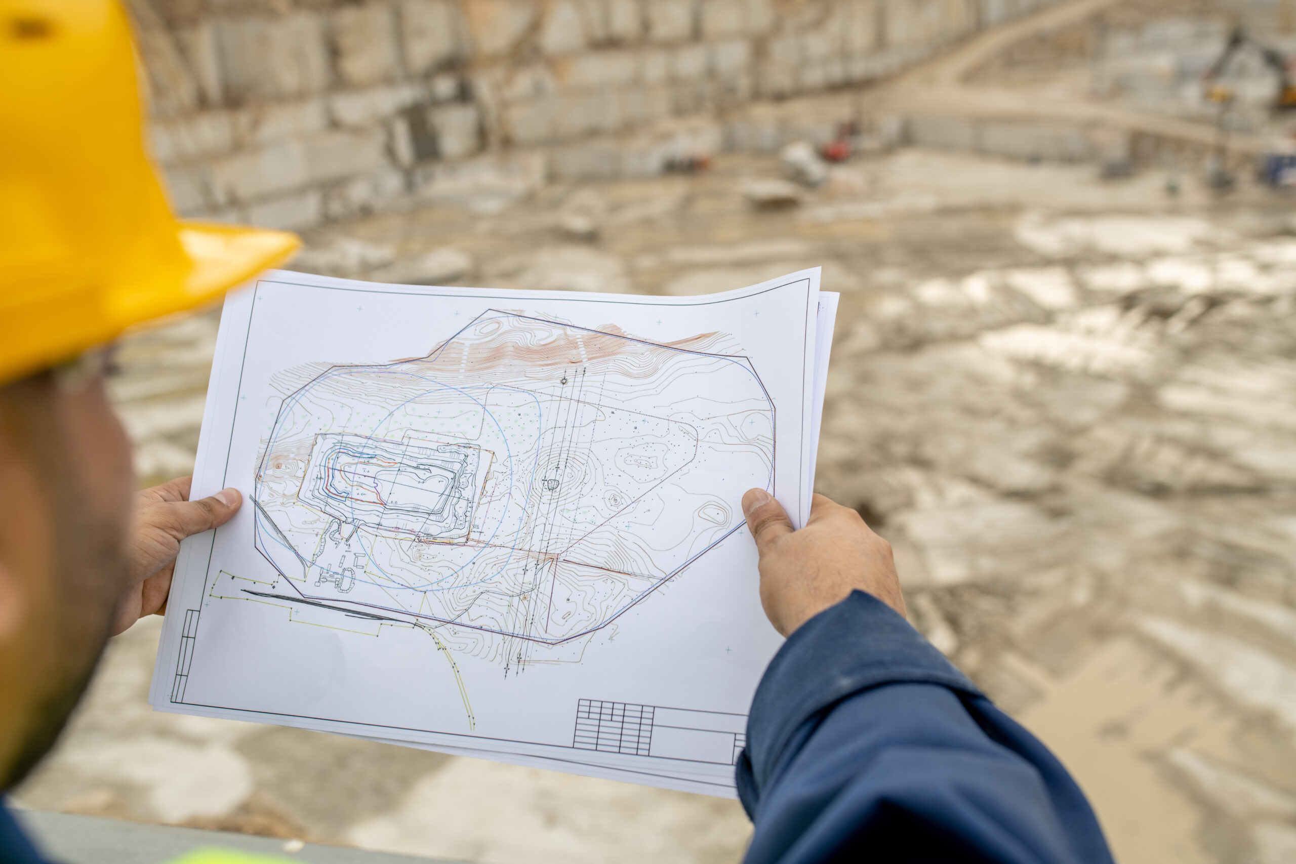
A professional land survey is a precise measurement and legal interpretation of a property’s boundaries, features, and dimensions, carried out by a registered surveyor. In simple terms, it is the official, evidence-based version of what your land actually is, not what has been assumed, estimated or passed down over time.
In Australia, only a registered surveyor is legally permitted to define property boundaries. They work from existing data, historic title plans, original survey marks, and modern measurement technology like GPS, drones and robotic total stations to confirm exactly where your boundaries sit, often to the millimetre.
It’s what makes a survey report so valuable when there’s a disagreement to resolve.
Types of Surveys Used in Property Disputes
Different disputes call for different surveys. Here’s a quick guide to the most relevant ones:
| Survey Type | What It Does | When You’d Use It |
| Boundary survey | Locates and marks the exact legal boundaries of a property. | Boundary or fence disputes, before building near a boundary. |
| Identification survey | Confirms whether existing structures sit within the legal boundaries. | Pre-purchase due diligence, encroachment concerns. |
| Easement survey | Identifies and maps registered easements affecting the land. | Shared driveways, access disputes, utility issues. |
| Detail and contour survey | Captures features, levels, and contours of the site. | Renovations, drainage disputes, retaining walls. |
| Subdivision survey | Defines new lot boundaries during a subdivision. | Subdivision projects, lot boundary errors. |
| Building set-out survey | Marks exactly where a new structure should be built. | Avoiding encroachments before construction begins. |
How Surveys Prevent Future Property Disputes
The cheapest dispute is the one you never had. Surveys are at their most valuable when they’re commissioned early, before the issue surfaces. A few smart times to act:
- Before you build or renovate: A building set-out survey ensures the structure goes in the right place from day one.
- Before you install a new fence or pool: Confirming the boundary first prevents expensive backtracking.
- Before you buy: A pre-purchase survey can flag encroachments, easements, or boundary errors before settlement; our guide to the importance of a boundary survey before buying property covers this in detail.
- Whenever your records feel incomplete: An updated survey on file is something you, and any future owner, will thank yourself for.
Signs You May Need a Property Survey
Not every situation calls for a survey, but these are the red flags worth paying attention to:
- There’s an active disagreement with a neighbour about the boundary or fence.
- The fence line and what you understood the boundary to be don’t match.
- You can’t find any survey pegs, or the ones that exist look disturbed.
- You’re planning a renovation, extension, pool, or new fence.
- You’re buying or selling, and you want certainty before settlement.
- Your title plan looks ambiguous, or the property has been subdivided in the past
If two or more of these apply, it’s worth getting a survey before things get more complicated.
So, How Do Surveys Resolve Property Disputes?
When a dispute arises, a survey resolves it in four key ways: by establishing accurate boundaries, identifying encroachments, providing legal evidence, and (often most importantly) defusing tension between the parties involved.
1. Establishing Accurate Property Boundaries
The first job is to confirm exactly where the legal boundary sits. A registered surveyor compares the official title data and cadastral records with measurements taken on site, then locates (or re-establishes) the original survey marks.
❗In many cases, boundary markers have been disturbed, removed or buried over time, which is why assumptions often creep in.
Once confirmed, the boundary is physically marked with new survey pegs and documented in a formal plan. This gives both parties a clear, shared reference point, removing guesswork entirely and replacing it with measurable certainty.
2. Identifying Encroachments
An encroachment occurs when a structure or improvement extends across a legal boundary without permission. It’s one of the most common triggers for property disputes, often involving features that have been in place for years without issue…until someone decides to check.
- Fences sitting partly or wholly on a neighbour’s land.
- Garages, sheds, or carports built over the boundary.
- Pools, decks, and pergolas that extend past the legal line.
- Retaining walls and landscaping that no longer line up with the title.
A land survey identifies these issues with precision, showing exactly where any overlap occurs. From there, the path forward becomes much clearer. In some cases, neighbours may agree on an adjustment or formal arrangement. In others, structures may need to be modified or relocated.
3. Providing Evidence for Legal and Council Matters
If a dispute escalates beyond informal discussion, a certified survey report becomes a critical piece of evidence. Australian courts, councils and planning authorities rely on survey plans because they are prepared by licensed professionals who must meet strict legal and technical standards.
A registered surveyor’s report isn’t an opinion; it’s a measured, documented record of what is actually on the ground compared to what the title says.
4. Preventing Escalation Between Neighbours
This one is often overlooked, but it’s where surveys do some of their best work. Most property disputes don’t need to end up in court. They escalate because both sides are working from assumptions, frustration, or miscommunication.
When a survey is introduced, instead of debating perspectives, both parties can see the same factual information laid out clearly and professionally. That alone often lowers tension significantly.
In many cases, disputes are resolved shortly after the survey results are shared, not because one side “wins,” but because the facts remove the need for argument altogether.

Property Disputes Surveys Commonly Resolve
1. Fence Line Disputes
Fence disputes are arguably the most common property conflict in Australia. They also tend to be the most misunderstood.
A key point many homeowners don’t realise is that a fence is not automatically the legal boundary. Plenty of fences are slightly off (sometimes by centimetres, sometimes more), and the only way to know for sure is a boundary survey.
In Queensland, dividing fences legislation generally assumes neighbouring owners share the cost of a boundary fence equally, but this only applies when the fence is actually positioned on the legal boundary. If it isn’t, the responsibility and cost-sharing can change significantly.
2. Building Encroachment Issues
When a garage, extension, or shed is built over the line, the consequences can be serious depending on the situation. In some cases, owners may be required to modify or remove the structure. Most of these situations could have been avoided with a building set-out survey before any structure went up. If you’re already in the middle of an encroachment dispute, a survey will tell you exactly how far over the line the structure sits, which is the starting point for any resolution.
3. Easement and Access Disputes
Easements are legal rights that allow someone to use part of another person’s land for a specific purpose, such as a shared driveway, drainage line or utility access corridor. While they are common, they are also frequently misunderstood.
Disputes often arise when an easement isn’t clearly understood, or when a property is sold and the new owner discovers it for the first time. A survey identifies registered easements, maps where they sit, and clarifies who has rights over what. If you’re navigating shared community arrangements, our overview of community title schemes in QLD is worth a read.
4. Subdivision Disputes
Subdivision projects can reveal boundary inconsistencies that have gone unnoticed for years. This is particularly common on older properties where historical records may not align perfectly with current on-site conditions.
A survey verifies the lot boundaries, identifies any inconsistencies with the title, and ensures the subdivision complies with planning controls. For more on the planning side, see our guide to QLD development assessment rules.
5. Adverse Possession Claims
Adverse possession is a legal principle that allows someone who has occupied land for an extended period (typically 12 years in Queensland) to potentially claim ownership, even if they are not the registered title holder.
These cases are highly fact-dependent and rely heavily on precise information about land use over time.
A survey is essential in these situations because it clearly defines what land has been occupied, how it relates to the legal boundary, and whether a valid claim may exist. It also plays a critical role in challenging claims where the occupation does not meet legal requirements.
Property Boundary Laws in QLD: What You Need to Know
Queensland’s framework around property boundaries comes down to three key pieces of legislation: the Land Title Act 1994 (governs how land is registered), the Neighbourhood Disputes (Dividing Fences and Trees) Act 2011 (sets out neighbour responsibilities for fences and trees), and the Surveyors Act 2003 (regulates the surveying profession).
On the Sunshine Coast, your local council also has planning rules that affect what you can build, where, and how close to a boundary. When neighbour disputes can’t be resolved informally, the Queensland Civil and Administrative Tribunal (QCAT) often handles them, and a current survey is one of the most useful documents you can bring to that process.
Why a Registered Surveyor Is Worth It
It can be tempting, especially with online tools and a tape measure, to try to sort out a boundary issue yourself. But there’s a reason boundary determinations are reserved for registered surveyors under Australian law: the stakes are simply too high for guesswork.
Registered surveyors are licensed and regulated by their state body (in Queensland, that’s the Surveyors Board of Queensland). They carry professional indemnity insurance, work to strict accuracy standards, and are legally accountable for the surveys they produce. When you engage one, you’re paying for clarity, accuracy, and a report that will hold up if it needs to.
How Level Up Surveying Helps Resolve Property Disputes
Level Up Surveying is a Sunshine Coast-based team of registered surveyors helping homeowners, buyers, builders, and developers across Queensland navigate property issues with clarity. We’ve sat down with worried neighbours, talked buyers through pre-settlement concerns, and produced expert reports that have settled disputes long before they reached a courtroom.
What sets us apart is the combination of deep local knowledge, modern technology, and plain-English reporting, ensuring you understand what we found and what your options are.
Dealing with a property dispute right now? Whether it’s a fence in the wrong place, a build that crossed a line, or a buyer who needs reassurance before settlement, our registered surveyors deliver clear, evidence-based answers.→ Book a property dispute survey with Level Up Surveying.
The Surveying Process, Step by Step
If you’ve never engaged a surveyor before, here’s how a property dispute survey typically unfolds.
- Site investigation and title research. We review the title plan, historical records, registered easements, and council documents to know what we expect to find before we get to site.
- On-site measurement and data capture. Our team visits the property with GPS units and total stations to locate existing marks and measure every relevant feature with millimetre precision.
- Data analysis and boundary determination. Back at the office, we cross-check field data against the legal records to determine where the true boundaries sit, re-establishing marks where they’ve been disturbed or lost.
- Survey report preparation. We produce a clear, plain-English report including a survey plan, marked boundaries, and identified encroachments; the document your solicitor, council, or neighbour will actually use.
- Resolution. Whether that means a friendly conversation over the fence, mediated agreement, council submission, or formal proceedings, the survey report is the foundation everyone works from.
The Bottom Line
Property disputes rarely solve themselves. They linger, they escalate, and they get more expensive the longer they’re left unaddressed. The single most effective thing you can do is bring in accurate, independent survey data.
A professional land survey gives you something rare in property disputes: clarity. It replaces assumption with fact, opinion with evidence, and tension with a path forward. It’s how disputes are resolved calmly, court cases get avoided, and good neighbours stay good neighbours.
If you’re on the Sunshine Coast or anywhere in Queensland, our team is here to help.
Ready to take the next step?
The earlier you bring in accurate survey data, the simpler and cheaper the resolution.
→ Get a quote from our registered surveyors. → Or browse our full range of surveying services.

Frequently Asked Questions
How much does a property dispute survey cost?
Cost depends on the size of the property, the complexity of the title history, and the type of survey required. The best approach is to request a tailored quote, so you know exactly what to expect.
How long does a boundary survey take?
Most residential boundary surveys are completed within one to three weeks from engagement to final report, depending on site complexity and current scheduling. Urgent matters can sometimes be expedited.
Can I rely on an old survey from a previous owner?
Sometimes, but only if it’s recent, complete, and the property hasn’t changed since. In a dispute, an outdated survey will often need to be refreshed to be accepted by the other party, council, or court.
Will a survey hold up in court?
A survey produced by a registered surveyor is legally recognised evidence in Australia and is regularly relied on in court, council, and QCAT proceedings. The surveyor’s professional accountability is part of what gives the report its weight.
What if my neighbour refuses to accept the survey?
It’s rare, but it happens. The survey report becomes a strong foundation for mediation, a council submission, or formal legal action.