Surveying is the foundation of almost every construction, development, and land management decision made in Australia. Without it, buildings end up in the wrong place, boundaries get disputed, and projects stall.
The industry has also changed significantly over the past few decades. Traditional methods (total stations, GPS, levelling equipment) have been the standard for years and still do a great job for many projects. But modern techniques like 3D laser scanning have introduced a completely different way of capturing site data, and it’s reshaping how surveyors, architects, and builders work together.
So how does surveying actually work? And what are the real differences between 3D laser scanning and traditional surveying? More importantly, which method is the right fit for your project?
This article breaks down how both methods work, where each one shines, and how to figure out which approach fits your project. No jargon overload, no sales pitch. Just the information you need to make a good decision.
Key Takeaways
- Surveying is the foundation of accurate construction, property development, and land management in Australia.
- Traditional surveying uses total stations and GPS to measure specific points. It is reliable, well-understood, and suits many common project types.
- 3D laser scanning captures millions of data points in minutes, producing detailed point clouds and 3D models.
- 3D scanning is faster and more detailed for complex sites. Traditional methods are more practical and cost-effective for simpler jobs.
- The right choice depends on your project’s scope, budget, timeline, and data needs.
- An experienced surveying team can assess your situation and recommend the best approach.
What Is Surveying and Why It Matters in Australia
Simply put, surveying is the process of measuring and mapping land to define boundaries, features, and elevation. It produces the spatial data that property ownership, construction planning, and legal compliance all rely on.
In Australia, property boundaries must be legally defined by licenced surveyors. Additionally, council approvals for development, subdivision, and construction all require accurate survey data.
- Architects need survey data to design buildings that actually fit the land.
- Engineers need it to plan drainage, services, and infrastructure.
- Builders need it to put structures in the right spot.
Get it wrong, and you are looking at boundary disputes, non-compliance, and costly rework.
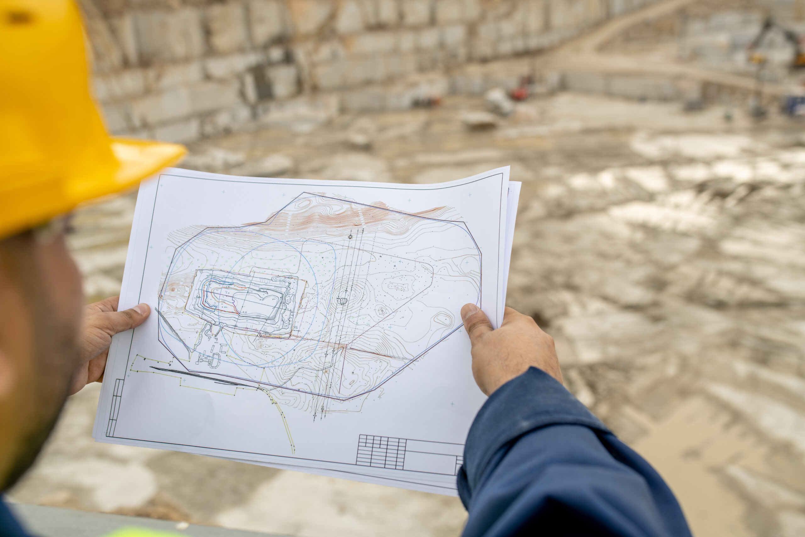
In practice, surveying covers everything from contour and detail surveys that map the terrain, to building set-out surveys that mark where a structure should go, to as-built surveys that confirm the finished result matches the plans. For land development, surveyors prepare subdivision plans, handle boundary identification, and work with councils to get approvals across the line.
If you are buying a home on the Sunshine Coast, subdividing land in Queensland, or setting out a commercial build, a professional survey gives you facts to work with instead of guesswork.
How Surveying Has Evolved Over Time
For centuries, surveyors worked with chains, compasses, and basic optical instruments. These tools were effective for their time, but the process was slow and physically demanding.
The introduction of electronic distance measurement in the mid-20th century was a significant leap forward, allowing surveyors to measure distances with far greater speed and accuracy. Then came total stations, GPS technology, and robotic instruments, each improving efficiency and precision.
Now the industry is going through another shift. 3D laser scanning, LiDAR, drone surveying, and digital twin technology are opening up new possibilities. These tools capture entire environments in fine detail, producing datasets that go well beyond what older methods can deliver.
The Core Principles of Surveying
Measuring Distance, Angles, and Elevation
Every survey boils down to three measurements: distance, angle, and elevation. Together, these define where any point sits in three-dimensional space.
- Distance is how far apart two points are.
- Angles (horizontal and vertical) give direction.
- Elevation tells you how high or low a point is relative to a reference level.
Establishing Accurate Reference Points
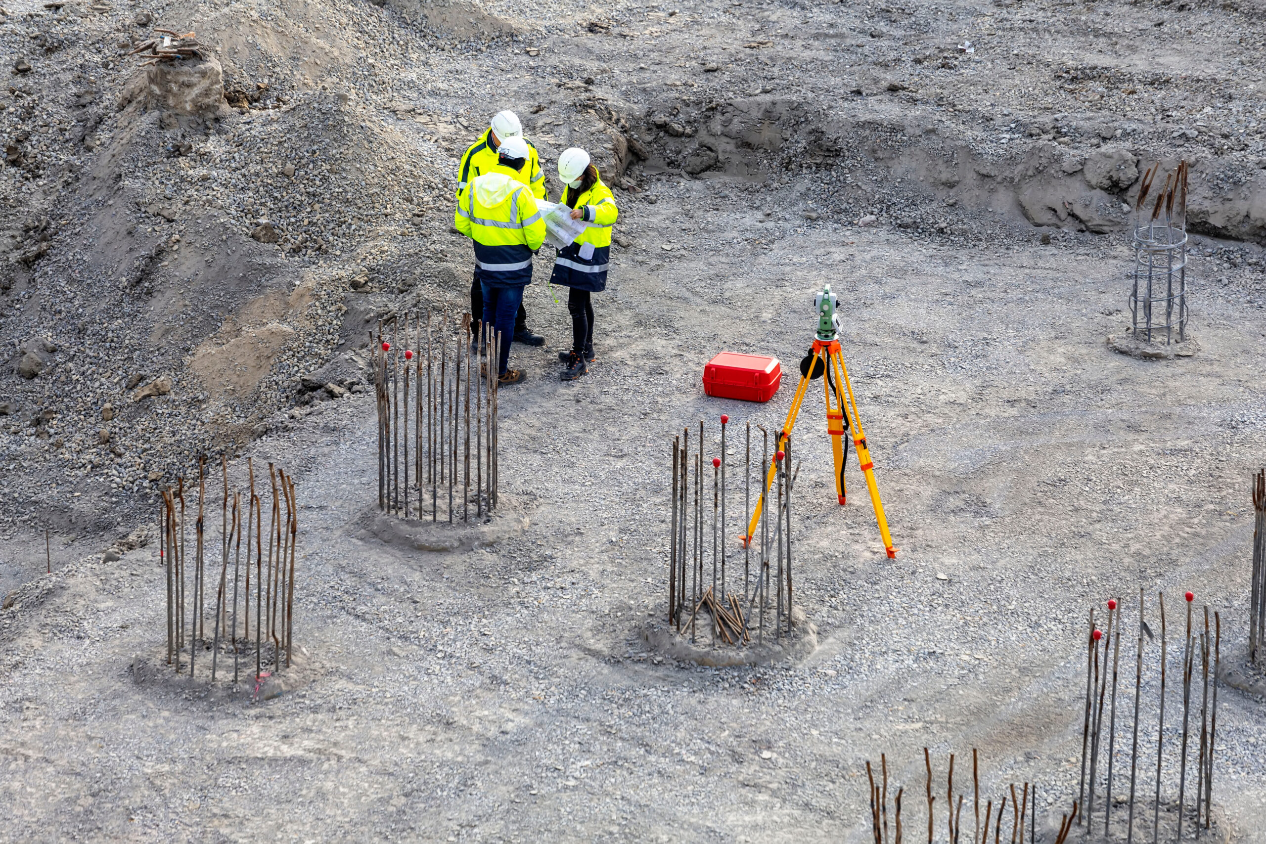
Before any measurements can be taken, surveyors need to establish a reliable starting point. This is done through control points and benchmarks, which are fixed positions with known coordinates and elevations.
Control points act as anchors for the entire survey. Every subsequent measurement is referenced back to these points, ensuring consistency and accuracy across the project. On larger sites, surveyors may establish a network of control points to maintain precision over a wide area.
In Australia, surveyors often reference the Geocentric Datum of Australia (GDA2020) and the Australian Height Datum (AHD) to ensure their measurements align with national standards.
The result is a precise, geo-referenced dataset that can be used for design, construction, legal documentation, and long-term asset management.
Applications Across Industries
- Construction and Infrastructure: Surveying supports every stage of a build. Traditional methods handle set-outs and compliance, while 3D scanning captures detailed site conditions, supports clash detection, and tracks progress. On infrastructure projects, both are used together, traditional tools set control and alignment, while scanning records accurate as-built data.
- Architecture and Heritage Preservation: 3D scanning is ideal for capturing complex and delicate structures without physical contact. It provides precise as-built data for design and restoration, and creates a lasting digital record for heritage conservation.
- Mining and Industrial Sites: Challenging environments make traditional surveying difficult. 3D scanning and drone LiDAR allow safe, remote data capture, delivering accurate measurements for volumes, stockpiles, and site conditions.
- Real Estate and Land Development: Traditional surveying remains essential for boundaries and subdivision plans. 3D scanning and drones are increasingly used on larger sites to enhance topographic mapping and support early-stage design.
What Is Traditional Surveying?
Traditional surveying refers to the established methods of measuring and mapping land using instruments that capture individual data points one at a time. A surveyor visits the site, sets up equipment, measures specific points, and compiles the results into plans, reports, and drawings.
Common Tools Used
Traditional surveying relies on a range of precision instruments. The most commonly used include:
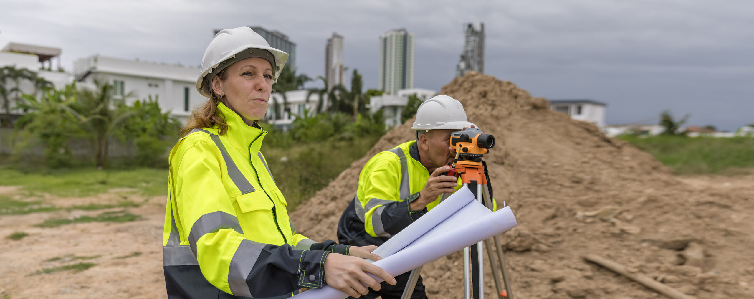
- Total Stations: The go-to instrument for most traditional fieldwork. A total station combines an electronic theodolite with a distance meter, measuring angles and distances from a single setup. Modern units are highly accurate and store data digitally.
- Theodolites: Measure horizontal and vertical angles with high precision. Mostly replaced by total stations in daily practice, but they still form the basis of how angular measurements work.
- GPS/GNSS Receivers: Use satellite signals to determine positions with centimetre-level accuracy. Great for establishing control points, covering large areas, and connecting local surveys to national coordinate systems.
- Levelling Instruments: Automatic and digital levels measure height differences between points, which is critical for elevation and contour data.
A Process Overview of Traditional Surveying
While every project is different, a typical traditional survey follows a well-established process which may include:
- Planning: The surveyor reviews project requirements, existing plans, and title documents to understand what needs to be measured and why.
- Establishing control: Reference points are set up on or near the site.
- Fieldwork: The surveyor sets up their instrument and takes measurements at specific locations across the site, providing a known framework for all subsequent measurements.
- Recording: Data is captured digitally on the instrument or a connected data collector.
- Processing: Raw data is checked, processed, and compiled into survey plans, maps, or reports.
- Delivery: Final products go to the client, ready for design, construction, or legal use.
Typical Applications in Australia
- Boundary identification and boundary surveys
- Construction set-out surveys
- Contour and detail (topographic) surveys
- Subdivision surveys and lot marking
- As-built and as-constructed surveys
- Lease surveys and lettable area calculations
Need help with a boundary or construction survey? Get in touch with our team for a free, no-obligation quote.
Limitations of Traditional Surveying
Traditional surveying is proven and reliable. But it does have limitations worth knowing about, especially when you are weighing it up against newer technology.
- Time-Intensive Data Collection: Measuring points one at a time takes time. A detailed topographic survey on a large property can run over several days. Every point has to be selected, measured, and recorded individually.
- Human Error and Accuracy Constraints: The instruments are precise, but the surveyor still decides which points to measure. That means details between those points can be missed. Environmental conditions like heat shimmer, wind, and poor visibility also affect readings. None of this makes traditional surveying unreliable, but there is an inherent layer of variability.
- Challenges with Complex or Hazardous Environments: Some sites are tough to survey the traditional way. Dense industrial facilities, intricate heritage buildings, or locations with safety hazards can limit access. Collecting a full dataset with point-by-point methods in these environments is often slow, difficult, or impractical.

What Is 3D Laser Scanning?
3D laser scanning or LiDAR (Light Detection and Ranging) is a modern surveying technique that captures the shape and geometry of physical environments by emitting rapid pulses of laser light and measuring how long each pulse takes to bounce back from surrounding surfaces.
Instead of measuring individual points one at a time, a 3D scanner captures millions of data points per second. Each point gets its own X, Y, and Z coordinate, along with intensity and sometimes colour data.
After capture, the scans are aligned and merged in processing software (called registration). Noise and unwanted objects are cleaned out, and the final result is a seamless 3D dataset that can be measured and explored from any angle.
Types of 3D Laser Scanners
- Terrestrial (Static) Scanners: Tripod-mounted. Capture highly detailed scans from a fixed position. Best for buildings, interiors, infrastructure, and heritage sites.
- Mobile Scanners: Handheld or vehicle-mounted. Capture data while moving. Fast and efficient for corridors, streetscapes, and large indoor spaces.
- Aerial Scanners (Drone-Mounted LiDAR): LiDAR sensors on drones capture topographic data from above. Ideal for large sites, rough terrain, and areas with thick vegetation.
The 3D Laser Scanning Process Explained
- Site Setup and Data Capture: The surveyor plans scan positions to get full coverage of the site. Control points are verified, and reference targets are placed around the area to help align the scans later. The scanner is set up at the first position, levelled, and switched on. Each scan takes anywhere from two to fifteen minutes depending on the equipment and project requirements.
- Scanning and Collecting Data Points: Once active, the scanner rotates and fires hundreds of thousands (sometimes millions) of laser pulses per second. Each pulse bounces off a surface and returns to the sensor, which logs the distance and direction.Each position produces a dense, spherical point cloud of everything visible from that spot. The surveyor moves to the next position and repeats. Overlapping datasets build up until the full site is covered.
- Data Processing and Registration: Individual scans are imported into processing software. The registration process aligns them using reference targets and overlapping features, stitching everything into a single unified point cloud.The data is cleaned (removing reflections, noise, and unwanted objects), quality-checked, and geo-referenced to a known coordinate system.
- Creating 3D Models and Digital Twins: Once the point cloud is finalised, the uses are broad. Surveyors and designers can pull measurements, create 2D plans and cross-sections, or build detailed 3D models of the physical environment. These are used across construction, infrastructure management, and facility operations, letting stakeholders explore, measure, and plan inside a virtual version of the real site.
Key Differences: 3D Laser Scanning vs Traditional Surveying
| Factor | Traditional Surveying | 3D Laser Scanning |
| Accuracy | High (mm-level with total stations) | Very high (sub-mm with modern scanners) |
| Speed | Slower; point-by-point | Fast; millions of points per second |
| Data Output | 2D plans, drawings, reports | 3D point clouds, digital twins, BIM models |
| Data Volume | Selective, targeted measurements | Captures entire environments |
| Upfront Cost | Lower for small/simple projects | Higher initial investment |
| Long-Term Value | May need re-survey if data gaps appear | Point cloud can be revisited without returning to site |
| Complex Sites | Harder in hazardous or confined areas | Excels in complex, industrial, or heritage sites |
| Safety | Requires physical access everywhere | Reduced site exposure; remote capture |
| BIM Integration | Limited; often manual data entry | Native integration with BIM platforms |
| Best For | Boundary surveys, small projects, simple sites | Large-scale, complex, heritage, industrial projects |
Accuracy and Precision
Both deliver high accuracy. Total stations hit millimetre-level precision for individual points, which is plenty for most surveying tasks.
3D scanning can reach sub-millimetre accuracy at close range. The bigger difference is coverage: scanning captures millions of points, so there are fewer gaps and less risk of missing something.
Speed and Efficiency
This is where the gap is widest. A traditional survey of a complex building might take several days. A 3D scanner can capture the same environment in hours.
That speed matters most on projects with tight timelines or limited site access windows.
Data Detail and Visualisation
Traditional surveys give you targeted data. The surveyor picks the most important points and the output is usually a 2D plan. That works well for straightforward jobs.
3D scanning captures everything the scanner can see. You can explore, measure, and analyse the point cloud long after the fieldwork is done. It also supports 3D visualisation, fly-throughs, and direct integration with BIM software.
Cost Over Time
Traditional surveying costs less upfront for simple projects. But if you need additional data later, someone has to go back to site.
3D scanning costs more initially. The trade-off is that the point cloud can be interrogated for new information without a return visit. For large or long-running projects, that often works out cheaper overall.
Regulatory and Compliance Requirements
Some survey types in Australia, especially cadastral (boundary) surveys, must be done by a registered surveyor using methods that meet specific legal requirements. Traditional methods are the established standard for these, and the deliverables (survey plans lodged with the titles office, for example) follow set conventions.
Not sure which method fits your project? Talk to our team for a free, no-obligation consultation.

Choosing the Right Surveying Method for Your Project
Key Factors to Consider
- Project scope and complexity: Larger, more complex projects get the most from 3D scanning. Simpler jobs may only need traditional methods.
- Budget: Think about upfront cost and long-term value. Scanning costs more initially but can save return visits.
- Timeline: If speed matters, scanning’s rapid data capture is a big advantage.
- Data requirements: Need 3D data, BIM models, or a digital twin? Scanning. Need a targeted 2D plan? Traditional.
- Site conditions: Hazardous, confined, or visually complex sites are better suited to scanning.
Hybrid Approaches: Combining Both Methods
Often the best results come from using both. A surveyor might use GPS and total stations to establish precise control points and define legal boundaries, then bring in a 3D scanner to capture detailed existing-condition data for the design team.
This is common on construction projects where the boundary and set-out work needs traditional accuracy and legal standing, but the architect or engineer also needs a full 3D model of the existing site. You get legal accuracy and detailed spatial data in one coordinated effort.
Working with Professional Surveyors
Choosing the right surveying approach starts with working with an experienced team that understands your project. A good surveyor will assess your needs, recommend the most suitable method (or combination), and manage the full process, from data capture through to delivery, so you receive accurate, usable results.
LevelUp Surveying brings over 20 years of experience across residential, commercial, and civil projects. Based on the Sunshine Coast, we combine local knowledge with modern technology to deliver practical, reliable outcomes. Whether it’s a small boundary check or a large-scale development, we take the time to understand your goals and recommend an approach that fits.
Our Services Include
- Boundary Identification Surveys for property purchases, fencing, and dispute resolution
- Construction Set-Out Surveys to translate your plans onto the ground accurately
- Subdivision Surveys, including lot calculations, proposal plans, and council coordination
- Drone Surveys for aerial data capture, topographic mapping, and large-site coverage
- Community Title Scheme Surveys for strata and community title developments
- Contour and detail surveys for site assessment and design integration
- File and plan integration to streamline your project workflow
Ready to level up your next project? Get a free quote from Level Up Surveying today.
Common Mistakes to Avoid When Planning a Survey
- Underestimating Project Scope: If the scope is not clearly defined upfront, important data gets missed and costs climb later. Spend time at the start discussing your full requirements with your surveyor.
- Choosing the Wrong Method: Not every project needs 3D scanning, and not every project can get by with traditional methods alone. A quick conversation with a professional surveyor will tell you which approach makes sense.
- Ignoring Data Processing Time: Capturing data is half the job. Processing, checking, and delivering it in a usable format takes time and skill. With 3D scanning in particular, point cloud datasets are large and need specialised software. Factor processing time into your project plan.
- Not Bringing in Experts Early: Involving a surveyor at the planning stage prevents problems later. Boundary issues, design conflicts, terrain challenges: these are all easier (and cheaper) to deal with before construction starts. Do not wait until something goes wrong.
Conclusion
Every successful construction, development, and property project starts with good survey data. The method you choose directly affects the quality of your outcomes.
Traditional surveying is reliable, cost-effective, and well-suited to a wide range of everyday tasks. 3D laser scanning is faster, more detailed, and built for projects that need richer spatial data. Neither is universally better. The right choice depends on your project.
At Level Up Surveying, we help clients across the Sunshine Coast and Queensland work out the best approach for their specific needs. Whether that is a traditional boundary survey, a detailed 3D scan, or a combination of both, we are here to help.