Buying property is exciting. It’s a big milestone, one that’s full of anticipation and plans for what comes next. But alongside the excitement, there’s a practical side of property ownership that’s easy to overlook and only becomes obvious when something goes wrong.
We’ve all seen stories of neighbours locked in boundary disputes, arguing over fences, driveways, or structures that sit just a little too far on the wrong side of the line. When those disagreements escalate, they can quickly turn into stressful, time-consuming, and expensive legal battles.
That’s where a boundary survey comes in. It’s a simple but highly effective way to clearly define what you’re actually buying and where your legal property lines sit. In this post, we’ll explain why a boundary survey is one step you should never skip when buying property.
Key Takeaways
- A boundary survey confirms the exact legal boundaries of a property, not just where fences or physical markers appear to sit.
- Skipping a boundary survey can lead to costly disputes, legal action, council fines, and forced changes after purchase.
- Boundary issues are more common in dense urban areas and small lots, where even minor errors can have major consequences.
- Professional boundary surveys identify easements, encroachments, zoning issues, and compliance risks early.
- Title insurance and online maps do not replace a legally recognised boundary survey.
- Boundary surveys are essential before buying, building, renovating, fencing, or subdividing property.
- Modern regulations and tighter accuracy standards make boundary surveys more important than ever in 2026.
- The cost of a boundary survey is minor compared to the financial and emotional impact of unresolved boundary problems.
- Accurate boundaries protect property value, support financing, and prevent delays in approvals or resale.
- A boundary survey provides peace of mind by ensuring you know exactly what you own and how you can use it.
But, What Is a Boundary Survey?
A boundary survey is a professional assessment that confirms the exact legal boundaries of a property based on its deed and official records. Beyond showing where fences or physical markers sit, a boundary survey verifies the true dimensions of the land, identifies any differences between what exists on-site and what’s recorded legally, and highlights potential issues such as encroachments or overlapping structures.
This information helps you understand not just where your property starts and ends, but also any limitations or shared access rights that come with it.
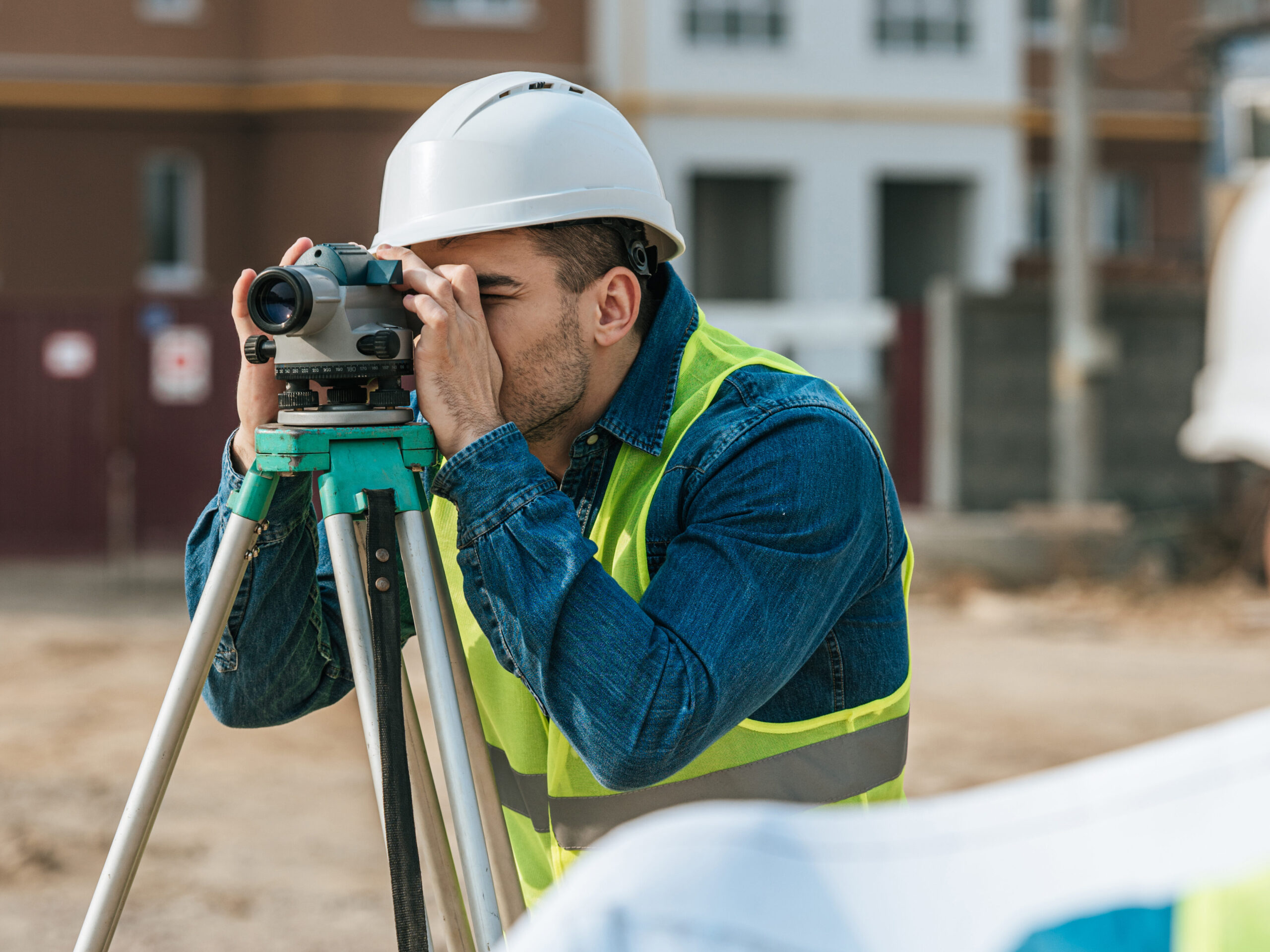
Surveyors use specialised tools and technology, including GPS systems, total stations, and sometimes drones, to take precise measurements. They also research historical property records, previous surveys, and physical evidence on the land to ensure boundaries are determined accurately and in line with legal requirements.
Are They A Legal Requirement?
While not always required by law, boundary surveys can be relied on as evidence in the event of a property dispute. If disagreements arise with neighbours or questions come up during a sale, a professionally prepared survey provides clarity and protection.
Many lenders and title insurers may also request one before finalising finance, particularly for properties with unclear or undeveloped boundaries. Local councils also require boundary surveys for a range of approvals, including building permits, subdivisions, zoning changes, and variance applications.
What a Boundary Survey Includes
- Surveyed Boundary Lines and Legal Descriptions: A licenced surveyor confirms your property’s legal boundaries by reviewing title documents and placing physical survey markers at key points. These survey marks define the legal boundary, not fences or GPS coordinates.
- Easements and Encroachments: The survey identifies any easements (the legal right that allows someone else to use part of a property for a specific purpose, such as access or utilities.) affecting the land and highlights encroachments such as structures, services, or landscaping that cross boundary lines.
- Existing Structures and Improvements: Buildings, fences, and other improvements are checked against the boundary to confirm whether they sit within the legal property lines.
- Zoning and Setback Compliance: The survey assesses whether existing structures comply with local zoning and setback requirements, helping avoid future approval or compliance issues.
- Flood and Environmental Considerations: Where relevant, the survey may note flood risks or environmental constraints that could affect development.
- Documented Compliance Issues: All findings are recorded in a formal survey plan that can be used for planning, approvals, or legal matters.
Why Boundary Surveys Matter More Than Ever
Property boundaries have always been important, but in today’s market, they’re more critical than ever. Rapid urban growth, tighter land availability, and increasingly strict regulations mean there’s far less room for error when it comes to defining what you own and how you can use it.
- Growing Cities and Tighter Lots Increase Risk: As cities continue to grow, property sizes are getting smaller and developments more compact. In high-density areas, particularly in established urban centres, even minor boundary inaccuracies can have major consequences. With small lots, zero-lot designs, and developments built right up to boundary lines, there’s no margin for guesswork.
- Boundary Accuracy Is Essential forSubdivision and Development: Boundary surveys are especially critical when subdividing land. Accurate boundary identification forms the foundation of every compliant subdivision plan. Even a minor deviation from the legal boundary can cause significant issues, including stalled approvals or rejected applications.
- Stricter Regulations Mean Higher Compliance Standards: Regulatory requirements around land surveying have become more rigorous in recent years, placing greater emphasis on accuracy, consistency, and clarity in boundary information. Councils are far less likely to accept surveys that don’t meet current compliance requirements, particularly for development and subdivision applications.
- The Cost vs the Risk: While the cost of a boundary survey varies depending on factors such as property size, terrain, location, and available records, it’s a relatively small upfront investment. In a market shaped by dense development and stricter regulations, a boundary survey provides certainty, supports compliance, and protects your investment.
When Smart Buyers Need a Boundary Survey
A boundary survey isn’t just something to consider after a problem appears. In many situations, getting one early is the smartest move you can make. Here are the key times when a boundary survey is especially important.
Before Buying a Home or Land
Buying property without confirming the boundaries is a bit like buying a car without lifting the bonnet…you won’t see the issues until it’s too late! A pre-purchase boundary survey can uncover problems such as fences, sheds, or even parts of buildings sitting outside the legal boundary. These issues often stay hidden until a neighbour raises a concern or you try to sell or build.
By identifying boundary issues early, you give yourself options. You may be able to negotiate with the seller, request that issues are resolved before settlement, or decide to walk away altogether. That small upfront cost can save you thousands in legal fees, rectification work, and stress down the line.
Before Building or Renovating
If you’re planning to build, extend, or renovate, especially near a property line, a boundary survey should be one of your first steps. Many homeowners rely on existing fences, old plans, or verbal assurances from neighbours, but these assumptions are a common cause of costly mistakes.
Builders and tradespeople don’t know your legal boundaries unless they’ve been professionally marked. A boundary survey ensures everyone is working from accurate information, whether you’re adding a deck, extending a home, or undertaking a major construction project. Getting boundaries confirmed before work begins can prevent forced changes, delays, or even demolition later.
Before Installing Fences or Walls
Fences are one of the most common triggers for neighbour disputes, and in many cases, they don’t sit on the true boundary at all. Installing a fence without confirming boundary lines can quickly lead to disagreements, legal action, or orders to remove and relocate the structure.
A boundary survey clearly marks where your property begins and ends and identifies any easements that may restrict where a fence or wall can be built. While it’s often skipped, this step can prevent expensive rework and long-term conflict with neighbouring property owners.
Before Subdividing Property
Subdivision requires precise boundary identification from the outset. Each jurisdiction has strict requirements, including development approvals, survey certification, and coordination with land titles offices. Errors or inconsistencies can delay the entire process or cause applications to be rejected.
A licenced surveyor plays a key role in preparing subdivision plans, managing the technical requirements, and working with councils and authorities. They also assist with matters such as new lot addressing and, where required, road naming. Without an accurate boundary survey, subdivision projects can quickly become complicated, costly, and time-consuming.

The Hidden Risks of Skipping a Boundary Survey
While not necessary, and skipping a boundary survey might seem like an easy way to save money upfront, but it can expose you to serious and often unexpected risks later. Even a little doubt is worth looking into!
- Boundary Disputes With Neighbours: Unclear or incorrect boundaries are one of the most common causes of neighbour disputes. Disagreements over fences, driveways, trees, or structures can escalate quickly, leading to legal action that costs tens of thousands in fees, along with ongoing stress and damaged relationships.
- Unseen Easements and Access Rights: Without a survey, easements can go unnoticed. These legal rights allow others to use parts of your land for utilities, access, drainage, or other purposes. Building over an easement can result in forced removal, costly redesigns, or legal disputes after the fact.
- Zoning Breaches and Council Penalties: Structures built outside legal boundaries or setback requirements can trigger council fines, approval delays, or demolition orders. Councils often require accurate survey data for compliance checks, meaning missing or incorrect boundary information can stall projects and approvals.
- Title, Insurance, and Resale Issues: Boundary discrepancies can limit title insurance coverage and raise red flags during resale. Buyers, lenders, and insurers may request updated surveys, and unresolved boundary issues can delay or derail a sale entirely.
- Reduced Property Value and Development Risks: Without confirming boundaries, you may overpay for land you can’t legally use. Missing boundary details can also hide underground services, access constraints, or site limitations that cause construction delays, safety issues, and unexpected costs.
Common Myths That Mislead Property Buyers
Misunderstandings about property boundaries are surprisingly common and can lead buyers to skip a boundary survey when they need one most. Here are some of the most common myths…and why they don’t hold up:
“Visible Fences Mean Accurate Boundaries”
Fences are rarely a reliable indicator of legal boundaries. Many are installed based on convenience rather than precision, and some may have been incorrectly placed decades ago. Legal boundaries are defined by title documents and survey plans, not by fences, walls, or hedges.
“Title Insurance Covers Everything”
Title insurance has limits. While it can protect against issues like forged documents or undisclosed liens, it doesn’t replace a boundary survey or guarantee accurate property lines. Boundary-related problems can still arise and may fall outside policy coverage.
“Only Large Properties Need Surveys”
Small properties often carry greater boundary risk, not less. Tighter lots and closer neighbours leave little room for error, making accurate boundary information just as important, if not more so, than on larger blocks.
“Online Maps or GPS Are Good Enough”
Online maps and smartphone GPS tools only provide rough estimates of property boundaries. Their accuracy falls well short of legal surveying standards and cannot be relied on for boundary confirmation or compliance.
“Surveys Are Too Expensive to Bother With”
A boundary survey is an investment in certainty. The upfront cost is minor compared to the potential expense of disputes, legal action, or forced changes to structures built in the wrong place.
Protect Your Purchase
Boundary surveys are essential protection for one of the biggest investments you’ll ever make. In a property landscape shaped by tighter regulations, denser developments, and stricter compliance standards, knowing your exact boundaries is no longer optional.
A professional boundary survey provides clarity, prevents costly disputes, and gives you confidence that what you’re buying is exactly what you’re entitled to use. While skipping this step may seem like a saving upfront, it often leads to far greater costs later. Investing in a boundary survey from the outset protects your property, your finances, and your peace of mind.
Ready to know exactly where your property stands?
At Level Up Surveying, we deliver precise, reliable boundary surveys that give you clarity and confidence. With over 20 years of local experience on the Sunshine Coast, our team provides clear, actionable results tailored to your property. Get in touch today to book your boundary survey and take control with confidence.